Local Adoption Pilot Database
Page status (temporary)
- StopLight --- Red Light (Not Ready)
- Yellow Light (Ready Pending Editing/Advice) - Bongi and Fabi
- Green Light (Go) - Bongi
Purpose
Samara has started collecting data for the networking and cross-pollination of pilot project wisdom. The purpose of this is to organise the formation and cross-pollination of learning between:
- Local adoption pilots we are seeking to understand and progressively support
- Ambassador support pods (3-4 people) who meet and share experiences and explore best practices.
We have begun the process of turning this initial data into a working database, which will act like a networking hub. To begin with the idea is to connect and help ambassadors co-support and co-create with an explicit focus on local adoption pilots.
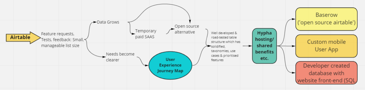
Initially we have transferred the data to an Airtable in order to have the flexibility to play with the structure and allow the users to drive development, before investing very much in a particular technology pathway.
We envision a period of collection and ongoing adjustments before designing a more in-depth user experience and choosing a more suitable software environment. A similar flexible database or user app will most likely provide the flexibility current feature requests are asking for.
- Any aspiring or graduated SEEDS Ambassadors can:
Development roadmap:
Samara has started supporting Ambassadors and established starter pods and pilot support using the following tables (sets of data):
- Location
- This links cities and towns to countries, ecoregions and bioregions within their bio-geo-realms.
- People interested in pilots and cross-pollinating learning
- This allows people to sign up so that they can link themselves to pilots and pods, as well as adding many of their interests related to pilots and/or joining a pod.
- Pilots
- This lists the pilot and pulls in information about the location based on the links above.
- This table gives a chance to develop and explore which commonalities will be valuable for Ambassadors to know about Pilots. At the moment this happens with:
- A type (what type of setting the pilot is in acknowledging technology access)
- A phase (what stage of development the pilot is at)
- This table and accompanying form allows much more detailed long-form feedback about various aspects of Pilots. In future these may be linked in a different way as the number of records grows. This is a wonderful potential precursor to web-pages which tell the story of each pilot as a case study.
- 'Ambassador Pilot Pods'
- This links people into 3-4 people pods in order to collaborate and share knowledge. The aim is to enable ambassadors to support each other in their efforts to creating, grow and support pilot projects.
The sections below display each of these starter tables and the partially converted data.
Pilot People Directory:
The primary purpose of the database is to connect people and facilitate regenerative processes and learning. One of the sets of information in the database is a people directory. This was created to allow ambassadors and those interested in joining pods or pilots to freely contact each other and look for areas of synergy or similar interests in relation to pilots. Initially much of the data is free input. This is so Samara and ambassadors can see what kind of interests and information appear. As the data grows we envision consulting ambassadors to create a more contained set of categories which are relevant to pilot needs.
Current Pilot data, organised by Type and Phase:
Ambassador 'Pilot Pods':
Ecoregion map:
Originally we started using the bioregions from the one earth website, but then discovered there were no exact defined borders or way for ambassadors to clearly identify the relevant location information for adding their information. We then discovered the below interactive google earth map which overlays the ecoregions, biome and bio-geo-realm. We have used this interlinked data to allow any city or town to be added to the database referencing the correct attached location data. This creates a user friendly experience that still encourages location in a much more relevant way to the regenerative work we are doing. Having to go into the map and find one's location is also a useful educational experience for many and naturally encourages discussions around these ecological factors entering into the pilot and pod activities.
Click the image below to visit the interactive map and find your location!!
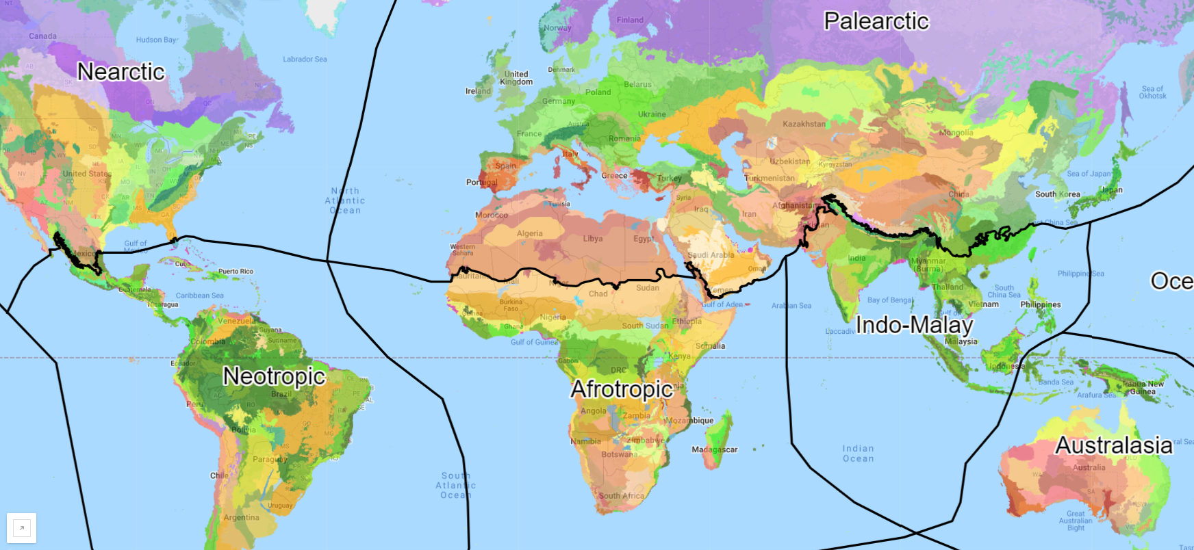
*Unfortunately there is not yet a search function in this map, but we are working on our own version which allows this. If you live in a small village or town, search it on another map and note the nearest large town to make it easy to locate in this map for now.
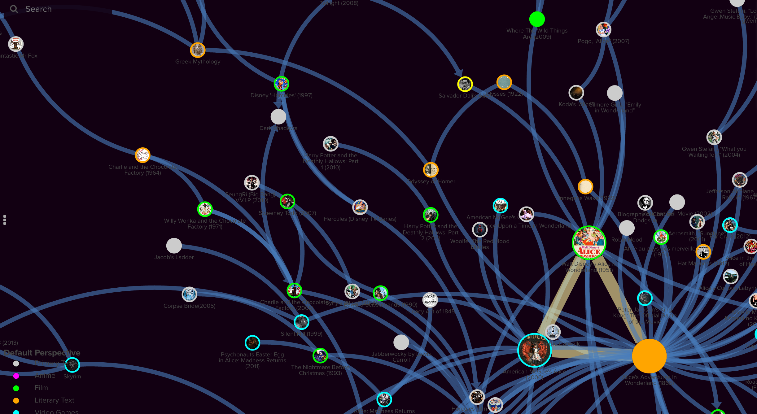
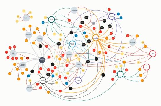
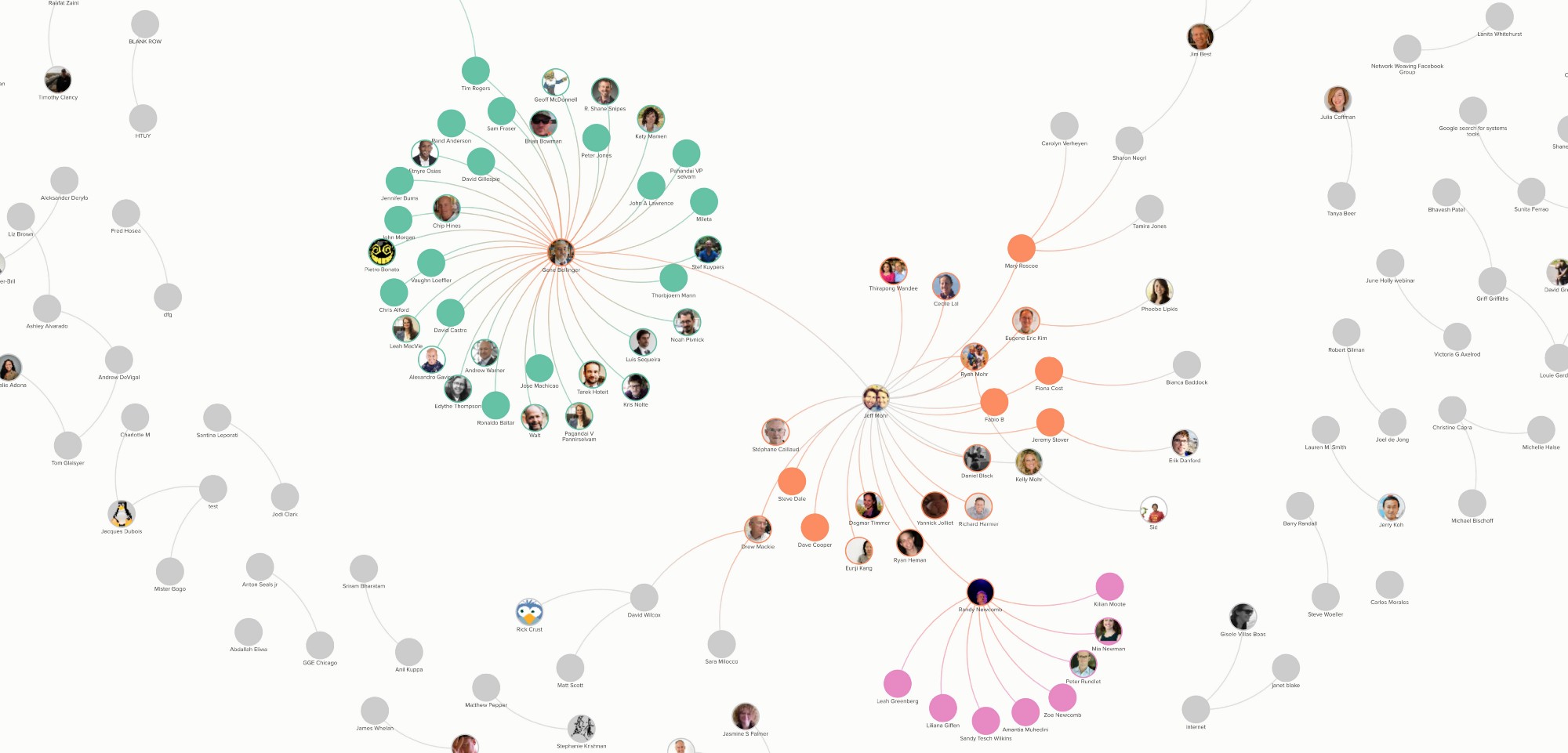
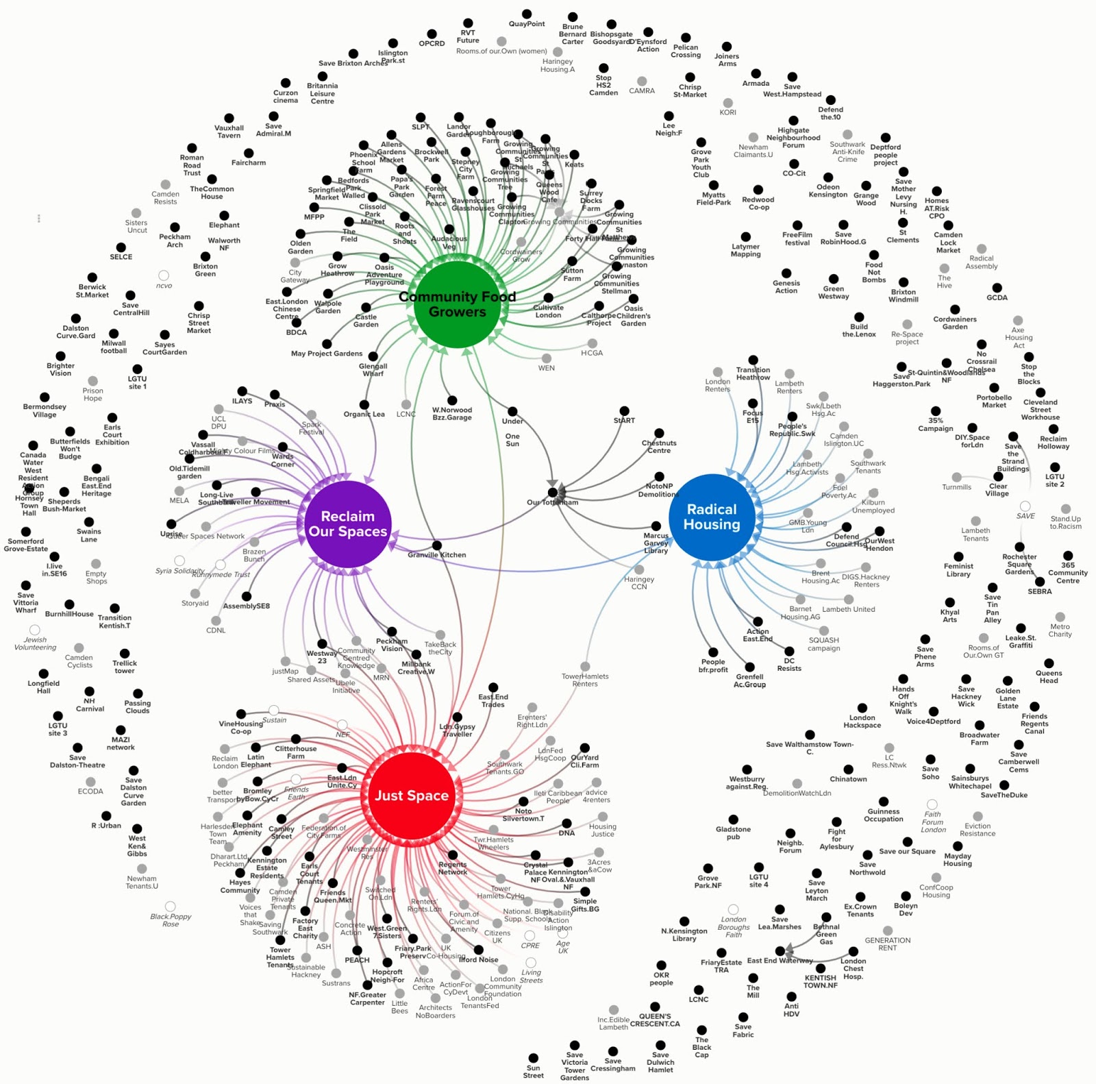
Visualization: Social System Mapping:
Samara is adapting this data with social system mapping in mind. At the moment there is not enough data or links to make a social map reveal very much.
People in Samara and involved in Pilots are consciously structuring the taxonomies, data sets and use cases to highlight and encourage social connections with a view to future mapping. This will help us to work with emergent patterns as much as possible as opposed to imposing perceived patterns or partial summaries. See some example maps below which show the kind of visuals we plan to produce over time:
Are you a SEEDS Ambassador or Citizen and interested in Pilot Projects? Have deep knowledge about local adoption and regional marketplaces? Add yourself above and get in touch!